


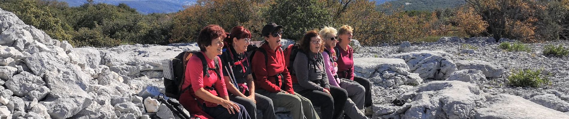
Tourris pyramide de Cassini

bernir
User
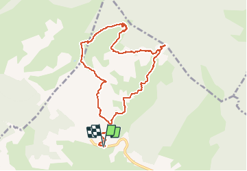

Length
10.7 km

Max alt
780 m

Uphill gradient
405 m
Km-Effort
16.1 km

Min alt
406 m

Downhill gradient
405 m
Boucle
Yes
Creation date :
2020-10-15 08:02:47.311
Updated on :
2020-10-16 10:44:12.23
7h05
Difficulty : Medium

FREE GPS app for hiking
 SityTrail
IGN / Geographical institutes
SityTrail Plus
The world is yours!
About
Trail Walking of 10.7 km to be discovered at Provence-Alpes-Côte d'Azur, Var, Le Revest-les-Eaux. This trail is proposed by bernir.
Photos


Positioning
Country:
France
Region :
Provence-Alpes-Côte d'Azur
Department/Province :
Var
Municipality :
Le Revest-les-Eaux
Location:
Unknown
Start:(Dec)
Start:(UTM)
738860 ; 4785804 (31T) N.
Comments